SICA: what the field knows in the first hours
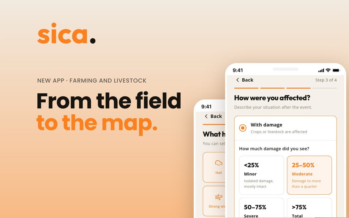
After a DANA (cut-off low), hail or frost, the people who know best what has happened are those standing in the field. That information is the most useful in the first hours, and it usually arrives late and scattered. We built SICA so it arrives on time and organised on a map.
The first hours
After an extreme weather event, the urgent question is where to act. Organisations and public authorities need a picture of the territory as soon as possible, and that picture is pieced together from loose fragments: phone calls, messages, photos without a location.
The people with the full information are in the field. Farmers, livestock keepers and technicians know which plot held up, which one did not and what is visible first thing in the morning. The problem is not that nobody knows. It is that there is no organised way to report it.
And where nothing has happened
Almost all the attention goes to the damage, and rightly so. But when deciding where to go first, it also helps to know which areas are fine. A plot without damage is information: it lets you rule out, prioritise and avoid spending resources where they are not needed.
That data is almost never collected, because nobody calls to say that nothing has happened. That is why in SICA, reporting "no damage" counts just as much as reporting damage.
What to record, with or without SICA
Whatever the tool, three pieces of data change everything if they are collected early: when you saw it, where (the plot or the SIGPAC parcel) and what was affected, with a photo if you can. And if there is no damage, it is also worth noting that down.
What SICA is
SICA, the Climate Impact Information System for Agriculture and Livestock, grew out of the experience of the DANA storms in the Valencian Community. Farmers, livestock keepers and technicians report from their phone how their farm has fared in four steps:
- Where you are: by GPS, on the map or with the SIGPAC parcel.
- What has happened: up to three phenomena at once, such as hail, frost or wind.
- How it has affected you: with damage, no damage or pending assessment.
- Photos and notes, if you want.
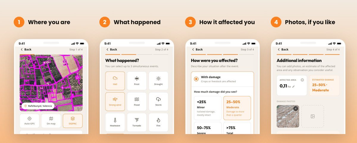
You can report without creating an account, and what you report reaches SICA Geo in an organised way.
SICA Geo is the desktop version, in the browser, designed for collaborating organisations and public authorities. It is a map of the territory to coordinate the response with data from the very first moment, with a review of each report and the indicators of the event. Whoever administers the system also has a panel to manage users, profiles and catalogues. Access requires an authorised user and profile.
SICA does not replace loss assessment or official procedures: what it provides is a map where before there were only scattered phone calls.
SICA has been running as a pilot with La Vega Innova since July 2026 and is now available to download on the App Store and Google Play.
From the field to the map.
Sources
- La Vega Innova, Piloto Agro Alerta de Impactos Climáticos, https://lavegainnova.es/pilotos/piloto-agro-alerta-de-impactos-climaticos/
- App Store, SICA app listing, https://apps.apple.com/es/app/sica-incidencias-en-el-campo/id6789524731
- Google Play, SICA app listing, https://play.google.com/store/apps/details?id=com.visualnacert.sica
Shall we talk about your case?
Tell us which crop you manage and we will show you how it applies on your farm, using data from your own plots.
Book a demo→